|
Click on image to enlarge
|
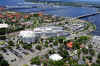
"Manatee
Memorial Hospital" Spring 2013 ©
Aerial view of the
"Manatee Memorial Hospital" and the
surrounding area in East Bradenton, Florida.
|
Click on image to enlarge
|
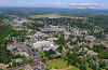
"Augusta",
Maine - summer 2012 ©
Aerial View of the State
"Capitol Building" as well as the
surrounding Augusta area, including the "Augusta
State Airport".
|
Click on image to enlarge
|
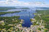
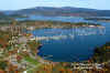
"Greenville"
at "Moosehead Lake", Maine - summer 2012 ©
Aerial view of the town
of "Greenville" on "Moosehead Lake".
|
Click on image to enlarge
|
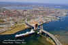
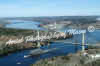
"Portland
Harbor"- Portland, Maine - spring 2012 ©
Aerial view of
the raised, "Million Dollar Bridge",
allowing a tanker ship to enter Portland Harbor.
|
Click on image to enlarge
|
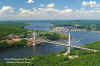
"Penobscot
Narrows Bridge" ©
Aerial view of the
"Penobscot Narrows Bridge" which spans the
Penobscot River, connecting the Town of Prospect with
Verona Island.
|
Click image to enlarge
|
Cianbro's
Barge, the "Columbia Boston" ©
Aerial view of
Cianbro's Barge as it makes its way down the Penobscot
River on 03-26-2009 passing beneath the "Penobscot
Narrows Bridge" in Bucksport.
|
|
Click image to enlarge
|
"Southwest
Harbor" ©
Aerial view
of Southwest Harbor, Maine.
|
|
Click image to enlarge
|
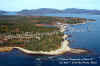
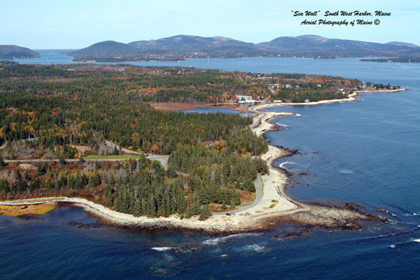
"Seawall"
©
Aerial view of
"Seawall", in Acadia National Park
in
Southwest Harbor, Maine.
|

Click image to enlarge
|

"Mt Katahdin" ©
Aerial
view of "Mt Katahdin" from 10,000 ft.
Published in the April 2007 edition of Down
East Magazine!
|
